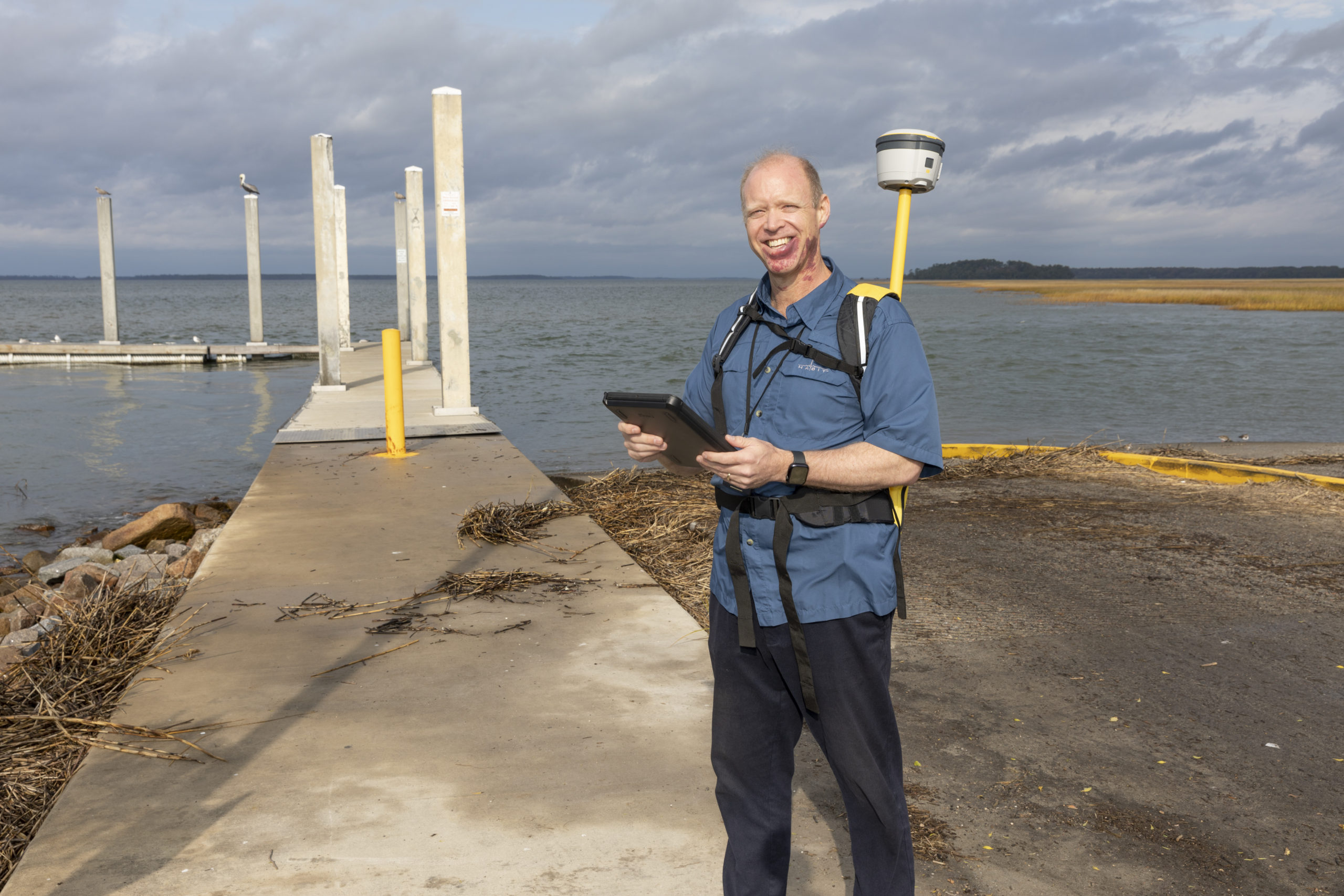
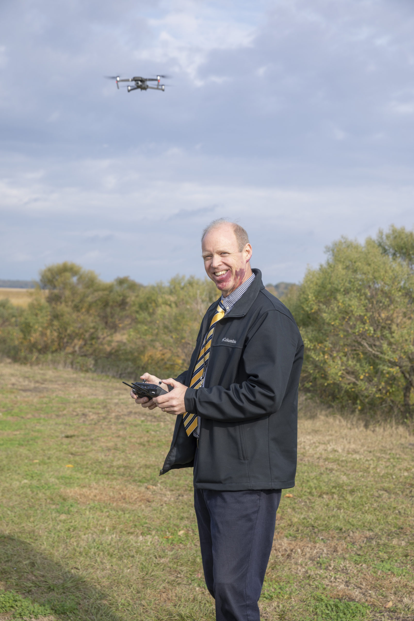
Dan Morgan
Using Science and Data to Make a Unique Difference in the Lowcountry
story by JENNIFER BROWN-CARPENTER photos by PAUL NURNBERG
 While most of us drive over the Richard V. Woods Memorial Bridge and glance at the sunset without thinking much of it, to Dan Morgan, that expanse means so much more. To him, the vastness is a part of the world around him, and that world around him matters to him a whole lot when it comes to his job.
Dan Morgan was born in upstate New York but was raised in eastern Oregon. His father was in the Air Force and was stationed in Oregon, working on radars for the Air Force. They lived in a small town, once dubbed the “Queen City of the Inland Empire,” Baker City. Baker City is a desert town, unlike the wet and beautiful Oregon that most of us imagine. “I thought the state flower was a tumbleweed,” Dan jokes. The population is less than 10,000 people and made for a great place to grow up.
Right after high school, Dan went to Brigham Young University in Provo, Utah, for one year. After that one year was up, he went on a mission for his church, The Church of Jesus Christ of Latter-day Saints. He was in the Netherlands (Holland) for two years, speaking Dutch and doing church service work.
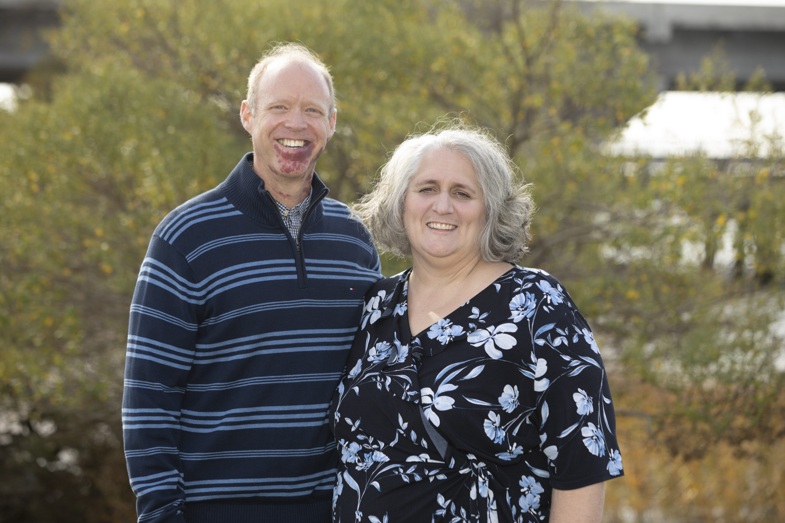
He came back and was preparing to go back to Brigham Young University, but then he met his future wife, Michelle, preparing to go to Utah State University in Logan, Utah. Dan ended up transferring to Utah State, where they got married and would both continue their education. Dan graduated in 1993 with a Geography degree, and in 1995 he received his masters in Agricultural Systems Technology and Education. Michelle earned her degree in Accounting.
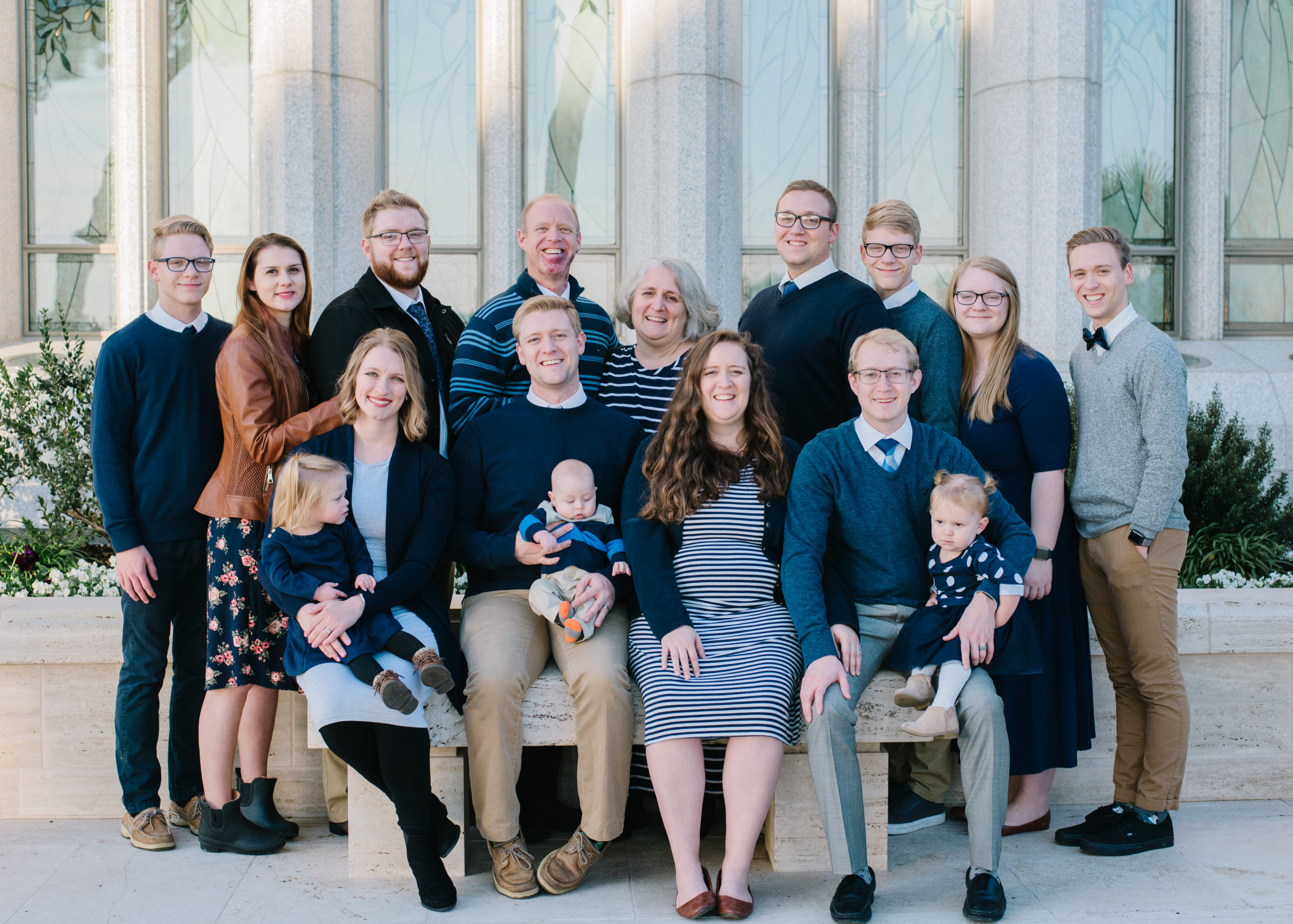
Dan and Michelle have eight children, six boys and two girls. After graduating from college, they started discussing where they would settle down. Michelle was raised in Columbia, SC, so they started looking around SC when searching for a job. An opportunity presented itself in Beaufort, and they have been here ever since, going on 26 years.
In college, especially after coming home from his mission, Dan leaned toward Engineering as a career. Dan’s father-in-law first put the idea of Geography as a career into his mind. His father-in-law is a renowned geographer and professional scientist. He asked Dan if he had ever heard of GIS. He went and talked to some professors about GIS and fell in love with it.
GIS stands for Geographic Information Systems. Esri (a geographic information systems company) defines GIS as “a framework for gathering, managing, and analyzing data. Rooted in the science of geography, GIS integrates many types of data. It analyzes spatial location and organizes layers of information into visualizations using maps and 3D scenes. With this unique capability, GIS reveals deeper insights into data, such as patterns, relationships, and situations—helping users make smarter decisions.” (esri.com/en-us/what-is-gis/overview)
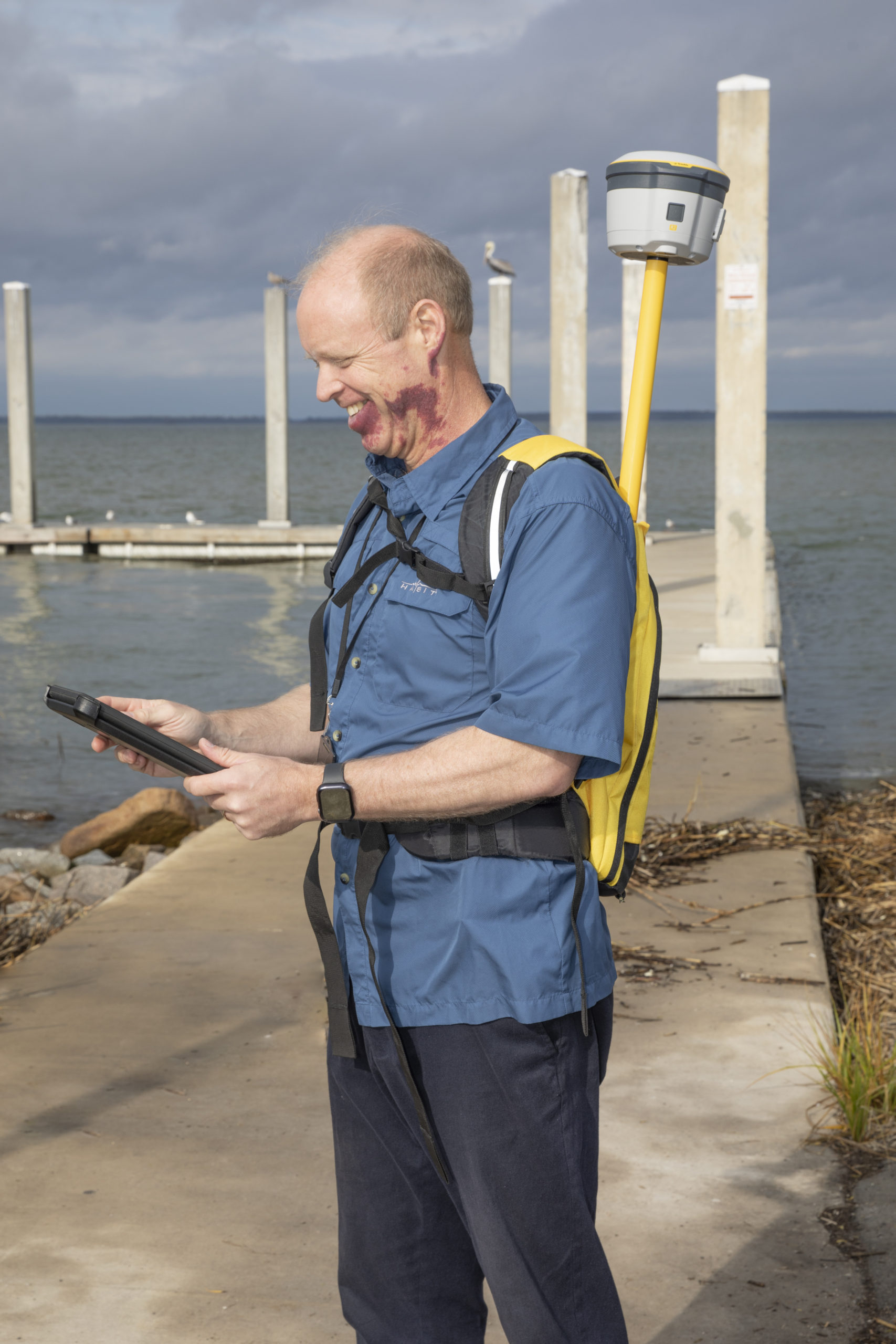 Dan defines GIS in a way that seems a little easier to understand. “It is the science of the study of place and space. You look at everything around you and where it is located, and how it all works.” This includes the weather systems, the ground, sea-level rise, cities, and so much more. It is really the study of everything that makes up the world around us.
Dan loves his job. He loves being able to solve problems and bring solutions using science and geography. Dan had a great mentor at Utah State University who made him want to give back to the people around him, and that desire has remained a big part of what he does and why he loves his job. He finds joy in giving back to the community through teaching. When he and his family moved here, he started teaching a class at the University of South Carolina Beaufort. He loved seeing the light bulbs go off for his students as they began to understand what geography is all about. Every year Geography Awareness Week falls in November, with GIS Day right in the middle. Dan participates every year by going to schools, from elementary up to high schools, and educating them on GIS and how they are using it every day and don’t even know.
Dan is very involved in the community through his church. He loves to volunteer and was on his way to deliver food with Help of Beaufort at the time of the interview. He also loves being able to use his knowledge of GIS to help the community. After Hurricane Matthew, the church helped from November to March, cleaning up trees and debris. The mapping helped them tremendously in this endeavor. They used their maps to find locations where lots of cleaning was necessary. Dan’s job is a constant way to give back to the community, but he also gives back through education and volunteering his knowledge and time.
 Everyday using GIS is something as simple as your route to work. We, as humans, make decisions without being in contact with something, like a satellite. Thinking, “I want to go here for lunch, but traffic might be bad, so I’ll go this way instead,” is an example of using GIS. GIS and GPS technologies are used a lot today, but any time you have used a map, an atlas, or just your mind to figure something out, you are using GIS. GIS is all about making things more efficient and safe. With the current COVID-19 pandemic, GIS can show you where the biggest outbreaks are and how they are affecting the world.
When Dan and his family moved here in 1995, he started working at the Lowcountry Council of Governments. He worked there for about nine months before being offered a job at the Beaufort County Government offices. He became the GIS Director in 1996 and has been working there ever since.
Disaster management is a big deal. Figuring out evacuation routes through aerial photography and imaging is a huge help that GIS is able to provide the community. They also help emergency management find the best locations for where to put new fire stations and much more. Providing this mapping allows for efficiencies, which helps these emergency services to make better decisions. GIS can give land-use data, zoning data, floodplain data, and sea-level rise. All of these things provide our leaders with the opportunity to create better solutions and more efficient plans for our future here in Beaufort.
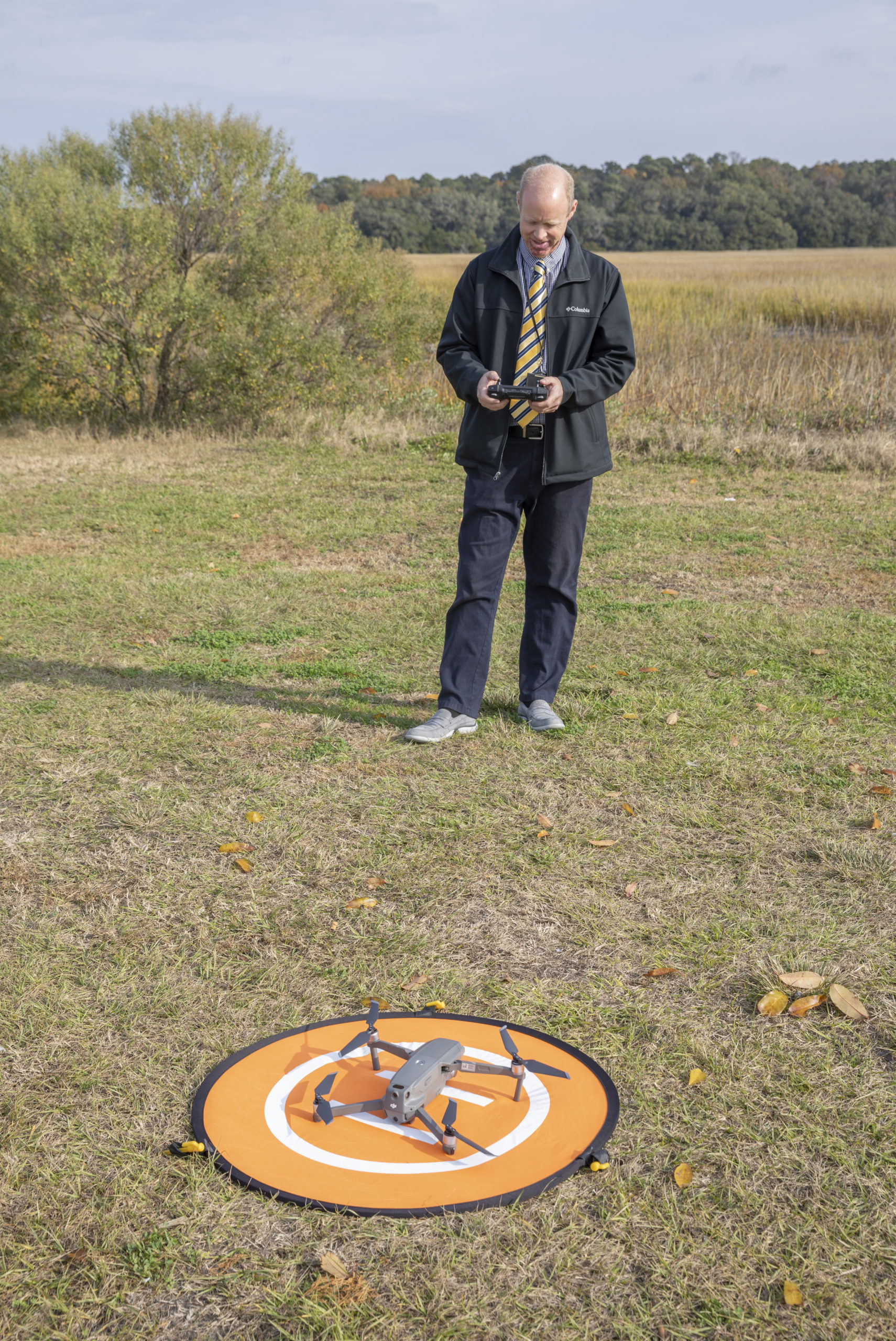 As technology advances, the services that GIS can provide will continue to grow. Not having to draw maps anymore with a pen, but having the technology to do it, allows them to spend more time analyzing the data and utilizing it.
Dan plans to keep providing education for inspiring students. “If I can continue to teach the next generation the importance of mapping and how they fit into it, and how the world around them affects them every day, that will be my future. I love talking about that.”
Dan and his wife love the Lowcountry. They have raised their children here, who have attended Robert Smalls International Academy and Battery Creek High School. They now have four grandchildren. His oldest daughter followed in her mother’s footsteps and received a master’s degree in Accounting. His oldest son is working on his Ph.D. in Geography at the University of South Carolina, with another studying Aeronautical Engineering at Utah State University and two children studying at Brigham Young University in Information Technology and Nursing. Dan loves being near the water and being able to take in the vastness of the Earth. “Some days, especially with all the hardship of the pandemic … just driving my car over the bridge and saying, ‘Wow!’ That’s why I love living here.”
When asked what he would like people to know about his job and what he is doing here in Beaufort, Dan said, “The Lowcountry is beautiful, and we continue to study and map it to keep it as beautiful as it is and keep all of the resources that everyone loves here.”